Introduction
Lizmap architecture
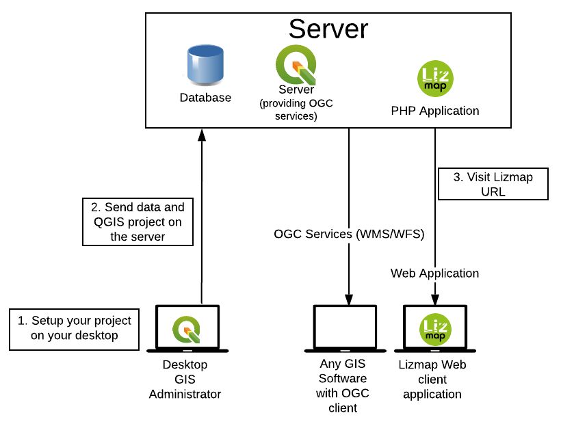
Data preparation
The map’s construction work is carried on his own computer with QGIS Desktop:
loading layers,
map creation,
organising and preparing data.
Map configuration & publication
To be able to put the map online, the publisher configures publishing options (scales, base layers, metadata) with Lizmap plugin in QGIS Desktop. Then he synchronizes his working folder with his server in intra- or extranet.
Data vizualisation
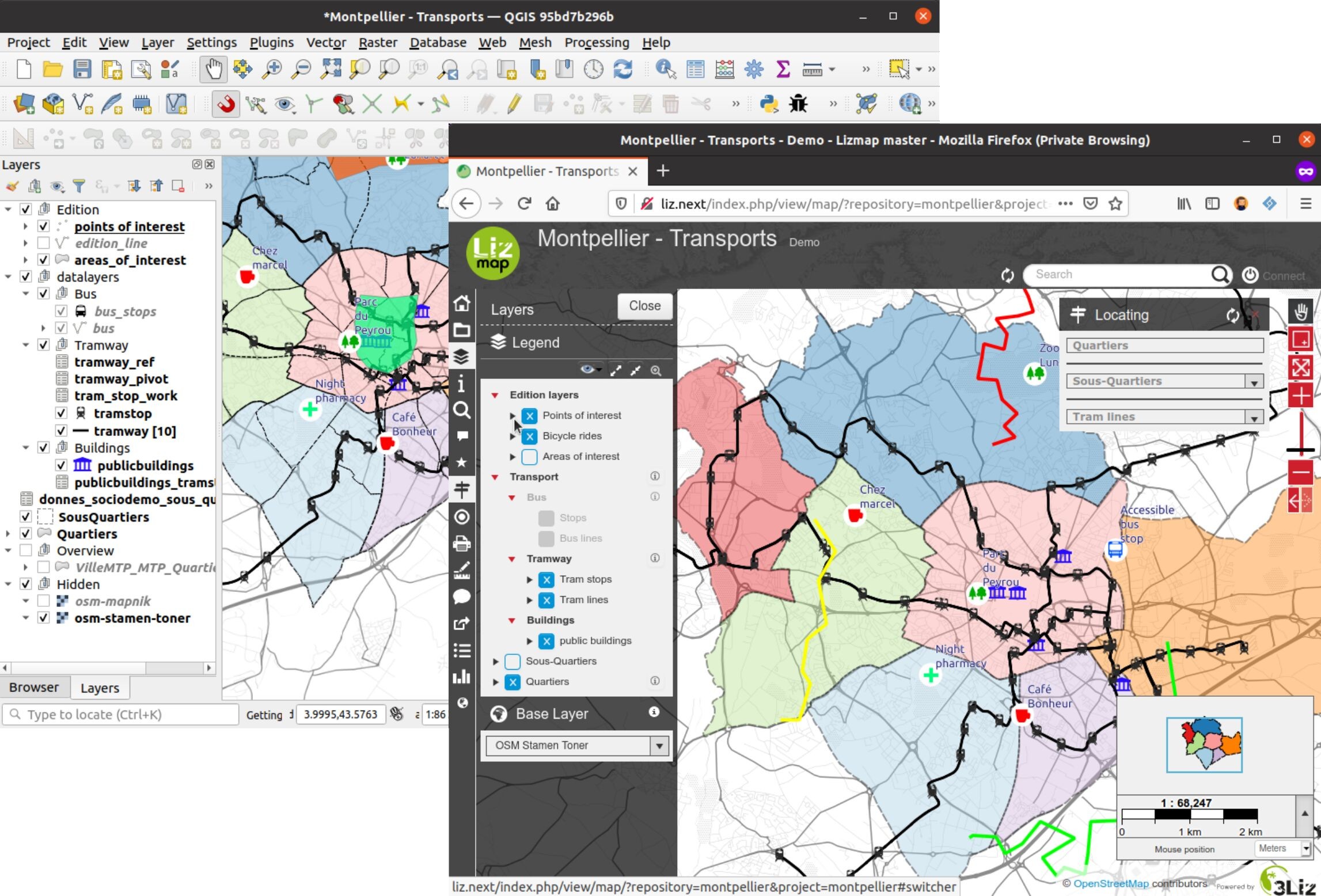
When synchronization is complete, The QGIS map can then be accessed on the Internet at the same. It is available on the application Lizmap Web Client with a Web browser (Firefox, Safari, Chrome, Internet Explorer).
For more information on versions (Web-browsers, QGIS Server, PostgreSQL etc) which are supported, it’s written on the Lizmap Web Client wiki page.
QGIS and QGIS Server
QGIS, a complete Desktop GIS software
Management of a wide range of data format for raster (GeoTIFF, ASC, NetCDF, etc.) and vector (SHP, TAB, MIF/MID, GML, GeoJSON, etc)
Management of key geographic database (PostgreSQL/PostGIS, Oracle, MSSQL, etc.)
Management of raster and vector layers, symbology, printing, processing
Performance and functional richness of a desktop GIS Software
Geographical standardized Web Services:
Open Geospatial Consortium, OGC, consortium for standardization of geographic information exchange through Internet
Web Mapping Service, WMS: standard for publishing map as image
Web Feature Service, WFS: standard for publishing geographic vector data
Web Coverage Service, WCS: standard for publishing geographic raster data
QGIS Server allows you to easily publish 3 types of standardized Web Services Geographic:
Install QGIS Server on a server
Configure properties of Geographic Web Services
Copy and paste the QGIS project and data files
QGIS Server and QGIS Desktop share the same rendering engine
Lizmap features
Open Source
Lizmap and the modules are opensource projects edited and managed by https://3liz.com
The source code is currently available on https://github.com/3liz/ Help is available through :
Github tickets
Our mailing-list : https://lists.osgeo.org/pipermail/lizmap/
On IRC on the #lizmap channel of https://libera.chat
Commercial support through 3Liz, contact mailto:info@3liz.com?subject=CommercialSupportRequest
Default features
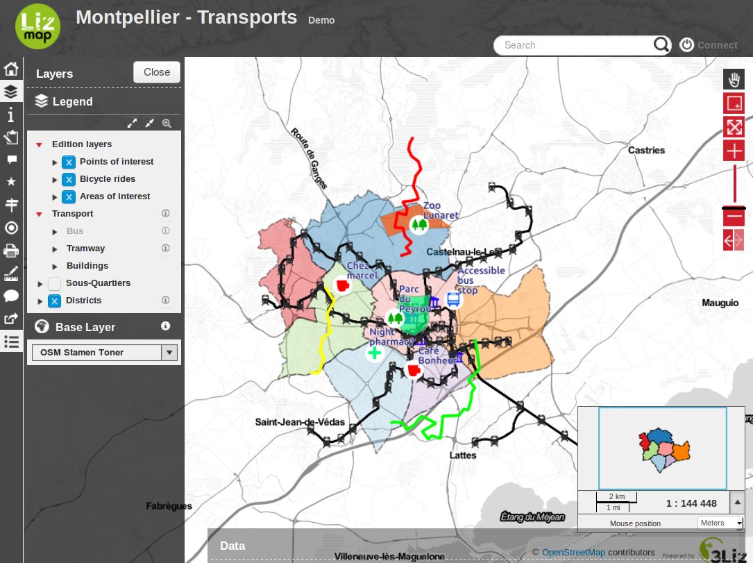
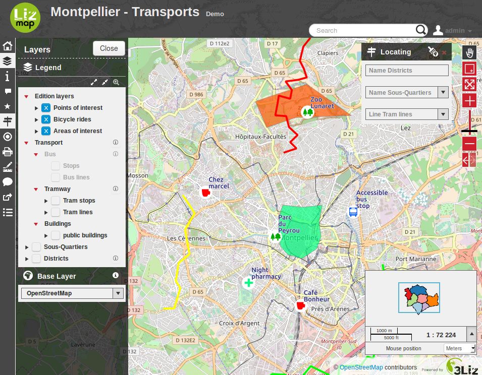
By default, Lizmap offers web maps with the following features:
pan
zoom on area drawn by the user
zoom more
selecting a zoom level with a level bar
zoom less
displaying the scale as a scale bar and digitally
The displayed legend respects the order and organization defined in QGIS.
The interface allows the user to hide the legend and take advantage of the map in the entire width of the screen. It also lets you view the information on the map (description, extent, contact).
Finally Lizmap is a proxy to the web services used to construct maps. It is therefore possible to use WMS or WFS requests through Lizmap. It is possible to secure access to web services for access in QGIS or ArcGIS. It is also possible to share these addresses with web services systems cataloging.
Additional Lizmap modules
Some modules can be added to Lizmap :
- AltiProfil
Display a profil with altitude according to a line and a DEM (Digital Elevation Model)
- Map builder
To combine many Lizmap projects into a single map viewer
- PgMetadata
For displaying metadata stored with the QGIS PgMetadata plugin. It is also providing a DCAT XML catalog, to be harvested by external services
- PgRouting
For displaying itinerary between two points using the PgRouting extension for PostGIS.
- Web Processing Service
To execute QGIS Processing algorithms or models on a server and view the results within Lizmap
Specific to France use-case :
- French adresse
For managing addresses
- French cadastre
For managing cadastre data
- Naturaliz
For managing species and observation data
Configuration with QGIS
Map’s configuration is done in QGIS.
One part comes directly from the QGIS project:
legend order and structure
layer symbology
location map with a group Overview in the legend
configure print templates via composers
The rest is done with the Lizmap plugin. This plugin allows to:
specify the layers and groups name in the Web interface
group the layers into a single WMS layer
set some layers as baselayer
set the display layer system: alone image or tiles
set the lifetime of the images in the cache
set the lifetime of the images in the network
set the popups for querying layer
set a link to the metadata
set the map scales
set the tools available with the map:
printing
measuring length, area and perimeter
using user geolocation (GPS)
address search in OpenStreetMap or Google
set external baselayers:
Google Maps
Bing Maps
OpenStreetMap
Géoportail IGN
set layers for navigation shortcut:
search in a layer field
zoom to the selected item
cascaded search within 2 fields of the same layer or between joined layers
Configuring with the Web back-office
The Lizmap back-office defines:
the directory list containing maps
users’ rights by map directory
using subdomain to improve the responsiveness of the interface.
In a nutshell
HTML5 interface compatible mobiles and tablets
Grouping maps by directory: application multi-directories and multi-projects
Management of access rights per directory for user groups
Automatic map cache management
Multilingual interface: English, French, Italian, Spanish, Portuguese, Greek
Using external baselayers: OSM, Google, Bing
Printing
Online edition: adding, spatial and filed changing, deleting
Zoom with localisation
Address search: Nominatim (OpenStreetMap engine), Google
Access logs
Requirements
Version of Lizmap Web Client requires:
Firefox ≥ 63
Edge ≥ 79
Chromium ≥ 54